

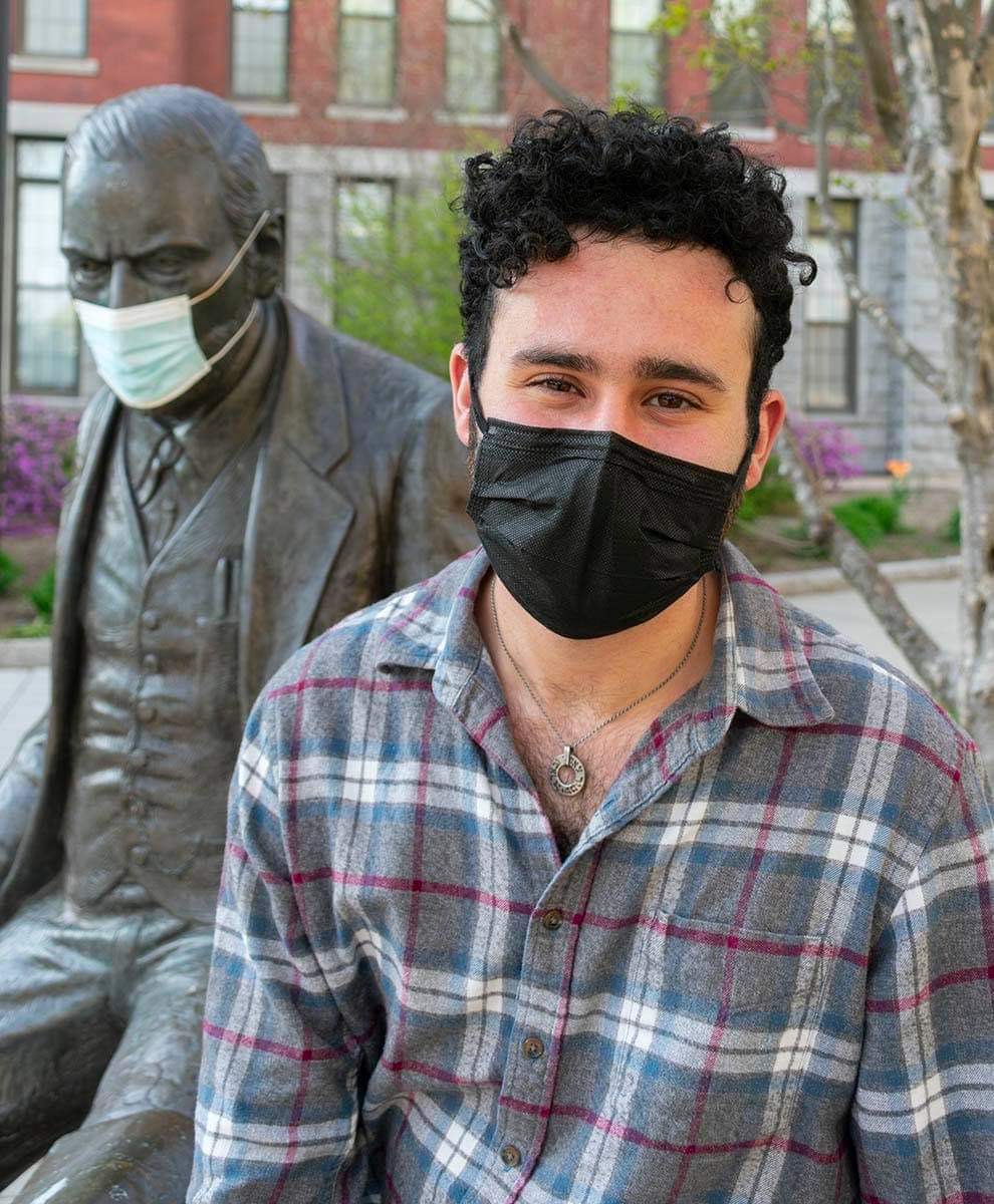
Garren Kalter, a graduate student at Clark University, is hoping to help transform the public transit system in Worcester to promote greater accessibility, better busing schedules, and higher quality service.
“One of the biggest things that was keeping people from taking the bus was getting on the bus in the first place,” Kalter said. “What does that mean for mobility, access to employment, access to quality of life? The transit service could potentially fill and could be leveraged to use.”
Kalter, who studied both urban geography and economics as an undergraduate at Clark, is looking to revamp the Worcester Regional Transit Authority (WRTA), with the underlying goal of adding more frequent bus stops, increasing ridership, and promoting greater understanding of the overall bus routes.
He originally started to examine the WRTA as part of a fellowship opportunity, called the Lois and Robert Green Internship (from what is now Clark’s Urban Studies Department) during the summer of 2020 with At-large City Councilor Moe Bergman. With his stipend, Kalter was tasked with working on his project for six weeks.The WRTA project continued and expanded beyond the internship.
“It’s really a fantastic candidate for a very vibrant bus system,” Kalter said. “It provides this really great opportunity to improve the quality of life for folks with increasing mobility while alleviating pressure. Everyone has the right to live in a city without a car.”
In Worcester, a trip by bus currently takes about 277 percent times longer than a trip by car, according to Kalter. The most often buses arrive during the weekday is at a 30-minute interval.
By reconfiguring the WRTA network, Kalter said the city will be able to reduce redundancies as well as implement more improvements that will lead to a more comprehensive service and increased ridership.
Kalter estimated, based on community census data, that roughly 46,000 residents do not have access to vehicles. In addition to that data point, there are about 36,000 students not included in the census that generally depend on transit.
“(Proper busing) is just so crucial to the health of a city,” Kalter said. “It all goes back to how we make a better environment and how we build it for people.” With less car emissions, the air in the city will be cleaner and would have less irritants in the air.
Kalter’s proposal focuses on an idea of corridors. “My focus was: how do I leverage my skill sets to optimize the WRTA,” Kalter said, “while keeping in mind, there have been a lot of proposals in the past to do a lot of improvements on the WRTA and all of them have cost like millions of dollars.”
Previous proposals had all failed, so Kalter wanted to make his plan as close to the current City Council budget as possible and as “painless,” as he called it, for the City of Worcester.
“Something in this report will be either functional or useful for the adoption of it,” Kalter said, adding that this is why he landed on the transit corridor system, calling it “appropriate for a City like Worcester, which has a high level of zone and has an appropriate density for busing.”
In this system, designated roads would be repurposed for what’s called multi-mobile transit. This allows for space for bus, bikes, cars, and walking.
“A lot of these roads are above grade to what might be expected for a car,” Kalter said. “There is room, using…normative plans for having bus/bike lanes or even a bus and bike lane.”
He points out nine particular areas for routes — which is a change from the current 20. They center around: Main Street, Greenwood Street, Grafton Street, Shrewsbury Street, Lincoln Street, West Boylston Street, Mill Street, Chandler Streets, and Park Avenue.
“I wouldn’t imagine that much of the stops will change, but the stops themselves do need a makeover,” Kalter said. “Visibility is super low. There is no feasible accessibility for elderly folks or mobility limited folks at all. The vast majority of stops in Worcester do not have a bench…If you can and you want to, that should be an accessible resource to you.”
Through a deep dive into public comments as well as feedback from the Zero Fare Movement, Kalter saw that this corridor method would solve the issue of where people pick up the buses.
“The theme that kept coming up over and over again was this idea of connecting,” Kalter said. “People have problems connecting, which makes sense when you actually look at the road map. There are routes that are so close to each other that you’d think would meet and make some tertiary hub of some sort…It just doesn’t do that.”
In addition, Kalter imagines a better redesign of the streets to accommodate the buses, pedestrians, bikes, and cars. This process has already started on Main Street downtown, as work is done to reduce travel lanes and add both bus and bike lanes.
“It’s obviously being adopted slowly, but it’s really just sitting there,” Kalter said. “These transit corridors are a really great way to streamline and catalyze not only proper busing in the city but also other plans that the city has.”
Kalter also sees the option for traffic signals that would prioritize buses. This ensures that the buses would be able to keep to a more regular schedule, as well. Congestion on the street would also be reduced by car drivers shifting to use other modes of transportations.
“On a place like Main Street where you could get a bike lane but probably could not get a bus lane in unless you get rid of some of the parking,” Kalter said, “if you program the traffic lights, you increase the reliability and you increase the number of trips that can be completed in an hour, which means that the bus system is operating sustainably and more effectively.”
Kalter envisions this system to allow for buses to arrive every 10 minutes at stops Monday through Saturday. The bus would arrive every 20 minutes on Sundays.
This would then eventually allow for an expansion to other corridors, Kalter said, potentially June Street, for example. These subsequent expansions can also then lead to the greater accessibility for those with limited mobility or a look into tree coverage, which is another city project.
“The transit corridor can be updated in concrete ways,” Kalter said. “It’s scalable…I have a lot of these subsequent capital improvements that can be paid through different federal policies and grant sources.”
While the plan highlights just Worcester, services outside of the city will also remain roughly unchanged. Kalter said that he wanted to keep up inter-community travel.
“We are taking advantage of Worcester’s unique advantages in this field to be a really good example for the rest of the United States,” Kalter said. “We’ll have equitable high service for everybody.”
Kalter plans to present his final report to the Worcester Transportation Committee sometime in the beginning of the new year.

Leave A Comment